Path of Environmental Disaster
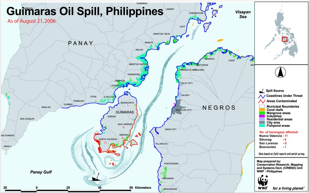
The oil slick coming from Panay Gulf was carried to the North by the sea current through Guimaras Strait. The oil slick was sighted about 500 meters off Brgy. Lanas, Barotac Nuevo. It hit mainland Panay starting at Bay-ang Point at the town of Ajuy, Iloilo last August 19.
At Ajuy, coastal barangays at the periphery of Canal Bay and Ajuy bay were affected. The coastal barangays are Day-ong, Sitio Culasi, Barredo, Tagohangin, Bocana Buglas, Siangon. The islands off the coast of Ajuy namely Nasidman, Calabasa Island, Guin-asyan Diutay, Guin-asyan Daku, Binongan-an, Brgy. Puntaburi, Tagubanhan Island were affected as well.
From Ajuy Bay, the oil slick moved up North through Apitong Pass while some moved left at Payong Point near the southern promontory of Tagubahan Island and to the Visayan Sea. Barangays affected are Brgy. Bangonon, Nipa, Plandico, Botlog, Polopiña, Tambaliza and Brgy. Loong.

0 Comments:
Post a Comment
<< Home